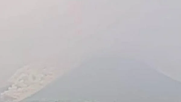
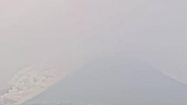
Mount Merapi, one of the most active and closely monitored volcanoes in the world, located on the border between the Special Region of Yogyakarta and Central Java, experienced a significant volcanic event on the afternoon of Wednesday, September 30, 2026. The Geological Agency, through the Center for Research and Technological Development for Geological Disasters (BPPTKG), reported that the volcano released a series of pyroclastic flows, locally known as "awan panas guguran," at 15:51 WIB. This latest activity underscores the persistent volatility of the volcano, which has remained a focal point for disaster mitigation efforts in Indonesia for decades.
Technical Details of the Eruption
According to the official data released by the BPPTKG, the pyroclastic flow traveled approximately 2,000 meters, or 2 kilometers, down the western and southwestern slopes of the volcano. The material was directed toward the upper reaches of the Kali Sat and Kali Putih rivers, which serve as primary natural drainage channels for volcanic debris during eruptions.
Seismographic instruments operated by the observatory recorded the event with an amplitude of 20.9 millimeters. The duration of the seismic signal associated with this specific flow was measured at 155.21 seconds. These metrics provide volcanologists with essential data to assess the energy release of the event and the potential volume of volcanic material displaced from the summit dome. Unlike explosive eruptions that eject ash high into the atmosphere, pyroclastic flows are high-density, high-temperature avalanches of gas, ash, and rock fragments that pose a severe threat to any structures or living beings in their immediate path.
Geological Context and Current Alert Status
Mount Merapi is currently maintained at Level III, or "Siaga" (Alert), a status that has been in effect for an extended period due to the ongoing growth of its lava domes. This status implies that the volcano is in a state of high activity and that eruptions—both effusive and explosive—could occur at any time.
The Geological Agency continuously monitors the mountain using a sophisticated network of sensors, including tiltmeters, seismometers, and GPS stations. These tools track the deformation of the mountain’s structure and the internal pressure exerted by rising magma. The period of observation from 06:00 to 12:00 WIB on the day of the event showed that seismic activity was characterized primarily by rockfall events (guguran). These constant rockfalls are indicative of the instability of the lava dome located at the summit, which frequently collapses under its own weight or due to gas pressure, triggering the pyroclastic flows observed on Wednesday.
Chronology of Recent Volcanic Unrest
The history of Mount Merapi is marked by periodic cycles of dome growth and collapse. In the current 2026 cycle, the volcano has exhibited a relatively consistent pattern of moderate activity. The event on September 30 follows weeks of heightened monitoring. Earlier in the month, geologists had warned that the accumulated volume of the lava dome had reached a critical threshold, increasing the probability of larger-scale collapses.
Local emergency response teams, including the Regional Disaster Management Agency (BPBD) in both Yogyakarta and Central Java, maintain a constant state of readiness. Their protocols are designed to facilitate rapid evacuation if the intensity of the volcanic activity transitions from Level III (Siaga) to Level IV (Awas). The primary strategy for local residents involves maintaining a strict buffer zone, particularly along the river valleys that originate from the summit, as these are the most likely paths for volcanic flows.
Official Recommendations and Public Safety Measures
In response to the afternoon event, the Badan Geologi issued a formal advisory to the public, emphasizing the importance of caution. The agency strictly advised residents and tourists to avoid the designated "danger zones." Specifically, the public is urged to maintain a safe distance from the areas identified as high-risk, particularly the riverbeds that act as conduits for hot clouds and cold lava (lahar) when rainfall occurs.
"The situation remains dynamic," a spokesperson for the Geological Agency noted. "While this specific event was within the expected range for the current alert level, we remind the community that the threat from volcanic hazards, including ashfall and pyroclastic surges, remains a reality for those living in the shadow of the mountain."

The government has further instructed local authorities to ensure that communication lines remain open and that evacuation routes are kept clear of obstructions. Farmers working in the slopes of the mountain have been advised to monitor updates from official sources regularly and to suspend activities if there are signs of increased seismic intensity or visibility of fresh ash deposits.
Broader Implications for the Region
The persistence of activity at Mount Merapi presents significant logistical and economic challenges. The region surrounding the mountain is densely populated and agriculturally productive. Frequent volcanic activity necessitates a delicate balance between allowing local communities to continue their livelihoods and ensuring their safety.
Agriculture, in particular, is highly sensitive to volcanic ash, which can contaminate water sources and smother crops. However, the volcanic soil of Merapi is also incredibly fertile, which has historically encouraged settlement in the area despite the inherent risks. To mitigate these risks, the Indonesian government has invested heavily in community-based disaster preparedness, conducting regular drills and establishing "disaster-resilient villages" (Desa Tangguh Bencana) around the mountain’s periphery.
Furthermore, the environmental impact of these eruptions is monitored by environmental scientists who track the distribution of volcanic aerosols and the alteration of river ecosystems. The accumulation of volcanic material in the Kali Putih and Kali Sat rivers requires periodic dredging to prevent flooding during the rainy season, as these materials can transform into hazardous lahars when mixed with heavy rainfall.
Regional Connectivity and Scientific Collaboration
The event on Wednesday occurred amidst a broader period of seismic activity across the Indonesian archipelago. The nation, situated on the "Pacific Ring of Fire," is home to hundreds of volcanoes, many of which are simultaneously active. This geographical reality has fostered a robust scientific infrastructure for volcanology.

The data gathered from the September 30 event will be compiled into the long-term historical record of Mount Merapi. This record is vital for refining predictive models. By analyzing the correlation between seismic waveforms, ground deformation, and the volume of pyroclastic flows, researchers are better able to predict the "trigger points" for more significant eruptive events.
For the international scientific community, Mount Merapi serves as a primary laboratory for studying basaltic-andesitic volcanism. The lessons learned from its frequent, manageable eruptions provide invaluable insights that are shared globally to improve disaster risk reduction (DRR) strategies in other volcanic regions.
Looking Ahead
As of the evening of September 30, the situation at the summit appeared to stabilize, though the alert status remains unchanged. BPPTKG continues to perform 24-hour monitoring, and the public is urged to rely exclusively on information disseminated through official channels, such as the Magma Indonesia application or the official website of the Geological Agency.
The recent activity serves as a stark reminder of the unpredictable nature of geological processes. While modern technology allows for better detection and faster warning times, the safety of those living in the vicinity of the volcano remains heavily dependent on the cooperation between the scientific community, local government, and the willingness of the residents to adhere to safety protocols.
As the sun sets over the horizon, the glowing signature of the summit remains a point of intense focus for observers. For now, the activity is confined to the immediate vicinity of the crater and its established drainage routes, sparing residential areas from direct impact. However, the "Siaga" status is a clear signal that the mountain is not yet at rest, and the period of observation will continue with heightened vigilance throughout the coming days. The coordination between the local police, military, and civilian volunteers in managing the perimeter of the danger zones will remain the primary defense mechanism against potential future escalations.