The "fungsional" (functional) designation—a term that appears with striking frequency in the one-year progress report submitted by Minister of Home Affairs Tito Karnavian to President Prabowo Subianto—serves as both a testament to resilience and a sobering admission of the work that remains. In the context of the massive recovery efforts across 53 regencies and cities in Aceh, North Sumatra, and West Sumatra, "functional" means that a lifeline has been restored, even if the infrastructure is not yet at its permanent, desired state. It acknowledges that while communities can once again access vital services, the scars of the late November 2025 natural disasters remain etched into the landscape.
A Year of Recovery: From Emergency Response to Structural Stability
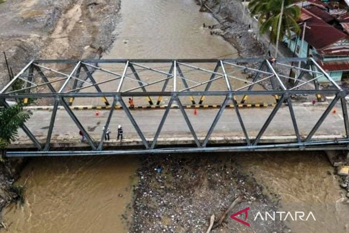
Nearly twelve months after the catastrophic flooding and landslides that devastated parts of Sumatra in late 2025, the region is navigating the transition from immediate disaster response to long-term structural reconstruction. The symbolic reopening of the Enang-Enang Bridge in Bener Meriah, Aceh, encapsulates this transition perfectly. For nearly a year, the severance of this critical artery isolated the Gayo Highlands. Its return to service, while currently handled through temporary structural measures, signifies the end of the emergency phase for the region’s logistics.
The Ministry of Public Works has already outlined the next phase of the strategy: the construction of the new Weihni Enang-Enang Bridge. This project is not merely intended to replace what was lost; it is envisioned as a new landmark for the Gayo region, designed to withstand future climate-related stresses. This two-tier approach—restoring mobility first, followed by building resilience—has been the operational blueprint for the Satgas (Task Force) for the Acceleration of Rehabilitation and Reconstruction of Post-Disaster Sumatra.
Chronology of the 2025 Sumatra Disaster and Initial Response
The disaster began in the final week of November 2025, when extreme hydrometeorological conditions triggered widespread flooding and landslides across three provinces. The sheer scale of the event—affecting 53 administrative regions—presented a logistical challenge of unprecedented proportions for the central government.
- November 2025: Initial impact occurs. Massive landslides isolate mountain communities, while low-lying areas in West Sumatra face catastrophic inundation.
- December 2025 – January 2026: Mobilization of heavy equipment to clear arterial roads. The establishment of the Satgas under the leadership of the Minister of Home Affairs.
- February – June 2026: Focus on the restoration of connectivity and the construction of temporary housing (huntara).
- September 2026: Preliminary assessments indicate that while primary national infrastructure is restored, agricultural land remains heavily impacted.
- November 9, 2026: Formal one-year progress report presented to President Prabowo Subianto at the Merdeka Palace, highlighting the "functional" status of infrastructure.
Statistical Overview of the Restoration Efforts
The data presented in the report underscores the monumental effort required to bring normalcy back to the affected provinces. The restoration of national infrastructure has been prioritized, as these roads serve as the lifeblood for both humanitarian aid and the resumption of regional trade.
Infrastructure Connectivity:
- National Roads: 100% of national roads affected by the disaster are now passable, with many segments upgraded to a higher, more durable standard than the original pre-disaster state.
- National Bridges: All 43 national-level bridges identified as damaged have been restored to a functional status.
- Regional Infrastructure: The recovery rate for local (regency and village) roads is more granular. Aceh stands at 94% recovery, North Sumatra at 98%, and West Sumatra at 83%. Significantly, 604 regional bridges have been repaired or replaced, though this represents only a portion of the total damage, indicating that many secondary rural routes remain compromised.
Humanitarian and Agricultural Restoration:
- Housing: A total of 20,803 temporary housing units have been completed, representing 99.84% of the target set by the government.
- Agriculture: In West Sumatra, 3,902 hectares of rice fields have been fully restored. North Sumatra has seen a 98% recovery of its 7,336 hectares of farmland.
- Economic Hubs: In Aceh, 115 out of 127 impacted traditional markets have returned to operation, allowing for the stabilization of local food prices and the resumption of small-scale commerce.
The Challenge of the "Last Mile" Recovery
Despite these gains, the data reveals a stark reality: the closer the infrastructure gets to the village level, the more difficult the recovery becomes. The report highlights that in Aceh alone, approximately 8,000 hectares of farmland—about one-quarter of the total affected area—remain buried under layers of mud and debris. In some instances, the thickness of the sediment reaches two meters, rendering standard farming equipment useless and requiring specialized excavation.
The environmental impact extends to aquaculture. Over 30,000 hectares of fish ponds and floating cages (keramba) were damaged. These areas are significantly more complex to rehabilitate than land-based crops, as they require not only the removal of debris but also the restoration of water quality and ecosystem balance, which are critical for the survival of aquatic stocks.
Official Responses and Strategic Implications
During the rapat terbatas (limited cabinet meeting) on November 9, 2026, the government emphasized that the "functional" nature of current infrastructure is a strategic bridge to the next stage of the recovery. Minister Tito Karnavian noted that the remaining ten regencies on the Satgas’s "priority list" represent the most challenging terrain. These areas are characterized by remote geography, fragmented local road networks, and difficult-to-access disaster sites.
The focus for the second year of recovery will pivot from broad-scale connectivity to localized, high-intensity reconstruction. This shift acknowledges that the economic vitality of the region depends on the small-scale farmer and the local trader, not just the passage of large logistics vehicles on national highways.
Socio-Economic Analysis: The Path Forward
The implications of this recovery effort are far-reaching. By prioritizing the restoration of agricultural and aquaculture lands, the government is attempting to curb the long-term risk of poverty and food insecurity in rural Sumatra. The destruction of these livelihoods poses a greater threat to the region’s stability than the damage to physical infrastructure alone.
Furthermore, the "functional" approach serves as a pragmatic lesson in disaster management. By accepting that temporary solutions are necessary to restart local economies, the government has been able to keep the pulse of the region beating while the more time-consuming, permanent, and resilient structures—like the future Weihni Enang-Enang Bridge—are planned and executed.
The transition into the second year of the recovery program will require sustained funding and, perhaps more importantly, the integration of disaster-resilient design into all future local government planning. The 2025 disaster exposed a lack of redundancy in regional infrastructure; building back better requires that the new networks are not only functional but also capable of withstanding the increasingly unpredictable climate patterns of the region.
As the Satgas turns its attention to the remaining 16% of unrepaired local roads in West Sumatra and the heavy sediment removal in Aceh’s agricultural belts, the goal is to shift from the "functional" label to "permanent and resilient." The success of the next twelve months will determine whether the recovery effort merely patches the wounds of 2025 or fundamentally secures the provinces against the inevitable challenges of the future. The roadmap is clear: the focus must remain on the rural periphery, where the true measure of success will be found in the restoration of every hectare of soil and every rural crossing.