
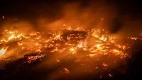
The National Disaster Management Agency (BNPB) has reported that more than 4,300 hectares of forests and peatlands across the islands of Kalimantan and Sumatra remain ravaged by severe land and forest fires, prompting a massive, multi-layered national response. As firefighting personnel grapple with dry conditions, erratic winds, and subterranean peat fires, federal and regional authorities have intensified both ground and aerial suppression operations, including advanced weather modification strategies.
The ongoing environmental crisis underscores the persistent vulnerability of Indonesia’s tropical ecosystems during extended dry spells. With firefighting teams deployed around the clock, the containment effort involves thousands of personnel, specialized equipment, and sophisticated meteorological interventions designed to induce precipitation over critical fire zones.
Current Scale of Devastation and Regional Breakdown
According to the latest official figures released by BNPB, the total estimated area of land currently undergoing active suppression in Kalimantan stands at approximately 3,392 hectares. Central Kalimantan bears the brunt of the disaster in the region, accounting for roughly 2,458 hectares of burning land. West Kalimantan follows with approximately 884 hectares affected, while South Kalimantan records about 52 hectares under active fire management.
Meanwhile, across the Sunda Strait on the island of Sumatra, BNPB has documented approximately 990 hectares of land impacted across three provinces. South Sumatra represents the largest affected area on the island, with roughly 889 hectares ablaze. Jambi records approximately 89 hectares of affected land, and Lampung has seen around 12 hectares compromised within the sensitive ecological boundaries of the Way Kambas National Works (TNWK). Notably, Riau province has not reported any active forest and land fire containment operations during this current monitoring cycle, indicating a temporary reprieve in that specific jurisdiction.
In addition to the primary hotspots in Kalimantan and Sumatra, localized flare-ups continue to challenge authorities on the island of Java. Specifically, the rugged terrain around the Arjuno-Welirang conservation area in East Java remains a focal point of concern, requiring inter-agency coordination, rigorous foot patrols, and targeted aerial reconnaissance to prevent further ecological degradation.
Ground and Air Operations Mobilized
To combat the spreading flames, the Indonesian government has deployed a vast network of personnel and mechanical resources. The frontline defense relies heavily on the Ground Task Force, which operates under the direct coordination of provincial command posts.
A total of 57,050 ground personnel have been placed on high alert across six primary provinces. Central Kalimantan leads the deployment with 16,387 personnel stationed in high-risk zones, closely followed by West Kalimantan with 14,458 personnel. In Sumatra, South Sumatra deploys 12,285 ground personnel, while South Kalimantan maintains 7,927 workers on the ground. Jambi utilizes 5,984 personnel, and Lampung maintains a specialized local response team of nine personnel focusing on protected zones like Way Kambas.
These boots-on-the-ground units are equipped with essential firefighting gear, including delivery hoses, suction hoses, nozzles, heavy-duty safety boots, portable pumps, backpack water pumps, fire swatters, and tactical radio communication devices. In challenging terrains such as the Way Kambas National Park in East Lampung—where 34 hotspots encompassing roughly 16 uncontained hectares persist—crews utilize thermal drones and ground observation posts. These technological tools are vital for detecting hidden subterranean embers smoldering deep within peat layers. Furthermore, the deployment of backpack pumps and extensive water hose installations stretching nearly three kilometers has allowed fire crews to channel essential water supplies directly to critical fire fronts.
Aerial suppression provides a vital counterpart to ground operations. BNPB has deployed a fleet of 61 specialized aircraft. This aviation armada comprises 24 units dedicated to tactical patrols, CASA surveillance, and Weather Modification Operations (OMC), alongside 37 heavy-duty water-bombing helicopters designed to suppress inaccessible canopy fires.
Weather Modification Operations and Meteorological Interventions
Recognizing that conventional suppression alone cannot easily extinguish large-scale peatland fires, authorities have heavily relied on Weather Modification Operations (OMC) to encourage rainfall and increase humidity over parched landscapes.
Data from operations conducted leading up to late October highlights the immense scale of these atmospheric interventions. On a single day of reporting, aerial seeding operations totaled 15 sorties, dispersing an aggregate of 14,300 kilograms of seeding materials.
In Central Kalimantan, the OMC task force executed eight sorties, consuming 7,200 kilograms of seeding agents. This total was divided into 5,200 kilograms of dry ice and 2,000 kilograms of sodium chloride (NaCl). Despite these aggressive efforts, initial monitoring periods reported no immediate rainfall in the targeted zones, illustrating the stubborn atmospheric stability in the area.
Conversely, similar operations in South Sumatra yielded more tangible environmental improvements. Conducting seven sorties with 7,100 kilograms of seeding materials, meteorological teams observed noticeable improvements in visibility by midday, alleviating dense haze that typically hampers both daily life and firefighting logistics.
In West Kalimantan, OMC targeting Sekadau, Ketapang, and Sintang successfully triggered light to moderate rainfall across seven regencies, directly impacting the three designated target zones. Similarly, precipitation was recorded in Kotabaru Regency within South Kalimantan. The execution of these weather modification missions remains dynamically adjusted to match shifting atmospheric conditions and the specific moisture deficits of each region.
Official Statements and Strategic Coordination
Berton SP Panjaitan, Acting Head of the Center for Data, Information, and Communication at BNPB, emphasized the comprehensive nature of the ongoing response during a recent official briefing.
"Various handling strategies continue to be pursued by the central and regional governments, assisted by volunteers, including weather modification operations using dry ice," Berton stated. He further detailed the meticulous logistical support backing the field operators, noting that tactical execution is continuously evaluated based on real-time data feeds from ground sensors and thermal imaging.
The integration of centralized command structures with local volunteers and forestry agencies has been credited with preventing the fires from reaching catastrophic proportions reminiscent of past severe El Niño years. Inter-agency cooperation ensures that priority is constantly reassessed, allowing rapid redeployment of assets to emerging hot zones before they can expand into uncontrollable mega-fires.
Broader Environmental, Economic, and Health Implications
The persistence of forest and land fires in Indonesia carries profound implications for public health, regional diplomacy, and global climate stability. Peatlands, which cover vast areas of Kalimantan and Sumatra, act as massive carbon sinks. When these ecosystems dry out and burn, they release gigatons of trapped carbon dioxide and other greenhouse gases into the atmosphere, accelerating global climate change and undermining national carbon emission reduction commitments.
Locally, the thick haze generated by the fires poses severe public health risks, triggering respiratory infections, eye irritations, and cardiovascular complications among millions of residents. Schools, local businesses, and regional transportation networks frequently face disruptions due to plummeting visibility caused by smoke pollution. Furthermore, the recurrent nature of these fires threatens biodiversity, destroying critical habitats for endangered species such as the Bornean orangutan, Sumatran tigers, and various endemic flora found within protected zones like Way Kambas.
As government agencies, military personnel, and volunteers continue their relentless battle against the flames, the situation remains a stark reminder of the delicate balance required to manage Indonesia’s natural resources. The combination of proactive weather modification, robust ground deployment, and advanced aerial surveillance represents a modernized approach to disaster management, yet long-term mitigation will ultimately depend on sustainable peatland restoration, strict enforcement of anti-burning laws, and community-level prevention initiatives.