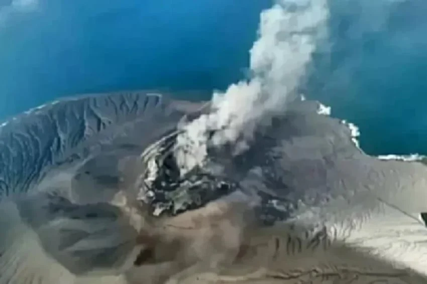
The Center for Volcanology and Geological Hazard Mitigation (PVMBG) recorded a sudden and intense surge in volcanic activity at Mount Anak Krakatau, located in the Sunda Strait between the islands of Java and Sumatra, resulting in 12 consecutive eruptions on Saturday night, October 31, 2026. The burst of subterranean activity occurred within a narrow, highly concentrated window, prompting immediate safety warnings from Indonesian geological authorities and local disaster management agencies.
According to official data released by PVMBG through the MAGMA Indonesia monitoring network, the sequence of eruptions began during the early evening hours at 18:30 Western Indonesia Time (WIB) and continued in rapid succession until 20:39 WIB. Despite the high frequency of the explosive episodes, monitoring posts faced visibility limitations due to atmospheric conditions and cloud cover, which prevented direct visual confirmation of the eruption columns from standard observation points. Furthermore, seismic instruments and local observers noted an absence of audible booming or rumbling noises typically associated with such explosive sequences, leading vulcanologists to characterize the event as a predominantly seismic and gas-driven eruptive phase.
In response to the sudden escalation, the geological agency has maintained a strict safety perimeter around the active volcanic complex. Authorities have urgently reminded residents, fishermen, and tourists to refrain from conducting any activities within a five-kilometer radius of the primary active crater, as well as maintaining a minimum distance of one kilometer from the nearby Pulau Baru. While the immediate vicinity remains hazardous, authorities have emphasized the importance of public composure, specifically urging coastal communities along the Lampung and Banten littorals to ignore unverified rumors concerning potential tsunamis and to rely solely on official communications issued by authorized disaster mitigation boards.
Chronology and Detailed Sequence of the October 31 Eruptive Episode
The chronological breakdown provided by PVMBG indicates a rapid escalation of internal pressure beneath the volcanic edifice. Prior to the 18:30 WIB onset, standard continuous seismic monitoring had already registered fluctuating tremor amplitudes, signaling an accumulation of magma within the shallow conduits of the volcano.
Between 18:30 WIB and 20:39 WIB, the volcano underwent 12 distinct eruptive pulses. In volcanological terms, a series of rapid, consecutive eruptions of this nature often indicates the periodic breaching of a hardened lava dome or the rapid ascent of gas-rich magma pockets reaching the surface. Because visual verification was hindered by darkness and weather conditions, monitoring scientists relied heavily on seismic instrumentation to confirm the frequency and duration of each explosive pulse.
By approximately 21:00 WIB, the seismic amplitude began to stabilize, signaling a temporary cessation of the rapid succession events. However, geological teams stationed at the Pasauran observation post in Banten and the Carita post continue to maintain 24-hour surveillance to detect any secondary events, tremors, or structural changes to the volcanic cone.
Historical Background and Geological Context of Mount Anak Krakatau
To fully understand the significance of the October 31, 2026 event, it is essential to examine the volatile history of the Krakatau complex. Mount Anak Krakatau, which translates to "Child of Krakatoa," emerged from the sea in the decades following the cataclysmic, world-altering eruption of its parent volcano, Krakatoa, in August 1883. That historic disaster generated massive tsunamis, obliterated entire islands, and released volcanic ash that affected global weather patterns for years.
Since its emergence above sea level around 1927, Anak Krakatau has been in a quasi-permanent state of constructive and destructive evolution. The volcano grows rapidly through frequent Strombolian and Vulcanian eruptions, adding layers of tephra, lava flows, and pyroclastic material, only to occasionally suffer massive structural collapses—such as the tragic flank collapse in December 2018. That 2018 collapse triggered a devastating tsunami that struck the coastal regions of South Lampung and Banten without warning, resulting in hundreds of fatalities and widespread infrastructural damage.
Because of this geological predisposition toward sudden flank instabilities and submarine landslides, any significant eruptive phase at Anak Krakatau—even those without massive ash plumes—automatically triggers heightened concern among disaster management professionals. The memory of the 2018 disaster remains a driving factor behind the swift, cautious responses of Indonesian authorities whenever the volcano displays increased restlessness.
Official Directives, Safety Protocols, and Hazard Mitigation
In the wake of the 12-fold eruption sequence, PVMBG reiterated that Mount Anak Krakatau remains at Level III (Siaga, or Standby), the second-highest tier on Indonesia’s four-stage volcano alert system. This status mandates a continuous state of readiness among regional disaster mitigation agencies (BPBD) in both Lampung and Banten provinces.
The primary hazards associated with the current eruptive phase include the potential projection of incandescent ballistic projectiles (lava bombs), heavy ash downpours in the immediate downwind direction, and secondary hazards such as lahar flows if heavy rainfall mixes with newly deposited volcanic ash on the slopes. Furthermore, vulcanologists have warned maritime traffic to exercise extreme caution when navigating the Sunda Strait, as floating pumice rafts and unexpected underwater disturbances can pose navigation hazards to commercial shipping and local fishing vessels.
Local disaster management officials have mobilized field teams to coordinate with village heads along the coastal strips of South Lampung, Tanggamus, and the western coast of Banten. These teams are tasked with ensuring that evacuation routes remain clear, early warning systems are fully operational, and community-level disaster response units are briefed on the latest geological updates.
Combatting Misinformation and Managing Public Anxiety
One of the most significant challenges faced by authorities during volcanic crises in the digital age is the rapid dissemination of unverified information and sensationalized hoaxes across social media platforms. Following the news of the 12 eruptions on Saturday night, various unconfirmed reports began circulating online, falsely claiming that a major tsunami was imminent or that a massive evacuation of the entire Sunda Strait coastline had been ordered.
The National Disaster Management Agency (BNPB), in coordination with PVMBG and local communication bureaus, moved swiftly to counter these falsehoods. Officials issued formal press statements and utilized emergency broadcast channels to reassure the public that while the volcano is displaying active behavior, there is currently no scientific evidence indicating a structural collapse comparable to the 2018 event, nor are there any indications of an impending tsunami.
Community leaders, religious figures, and local influencers have been enlisted to help disseminate accurate, science-based information to residents. Citizens are continually reminded to cross-reference any alarming claims about seismic activity with official channels, such as the official website and social media handles of PVMBG, BMKG (Meteorology, Climatology, and Geophysical Agency), and BNPB.
Implications for Regional Economy, Tourism, and Aviation
While the eruptions of Mount Anak Krakatau are an ordinary manifestation of its active geological life cycle, the secondary economic and logistical implications for the surrounding region require careful management. The Sunda Strait is one of Indonesia’s most vital maritime corridors, connecting major ports in Java and Sumatra and facilitating heavy commercial shipping traffic.
Although the current eruptive activity has not caused significant disruptions to commercial maritime lanes or aviation operations—largely due to the absence of towering ash columns reaching high-altitude flight paths—local tourism operators in coastal areas such as Anyer, Carita, and Kalianda have experienced temporary cancellations and heightened anxiety among weekend visitors. Regional tourism boards are working closely with safety agencies to provide transparent updates, ensuring that tourists understand the geographical limitations of the danger zones and recognize that safe areas remain fully operational and unaffected by the volcanic activity.
Conclusion and Future Outlook
The 12 consecutive eruptions of Mount Anak Krakatau on the night of October 31, 2026, serve as a stark reminder of Indonesia’s position along the Pacific Ring of Fire, a zone characterized by frequent seismic and volcanic activity. While the immediate event concluded without reported casualties, structural damage, or tsunami generation, it underscores the critical need for unremitting vigilance, advanced technological monitoring, and robust community preparedness.
As PVMBG and associated scientific bodies continue to monitor the inner workings of the volcano through real-time seismographs, satellite telemetry, and ground-based observations, the emphasis remains on proactive risk reduction. By maintaining the Level III (Siaga) status, enforcing safety perimeters, and actively suppressing public misinformation, Indonesian authorities continue to balance the scientific reality of an active volcano with the safety and well-being of the millions of citizens living within its shadow.