
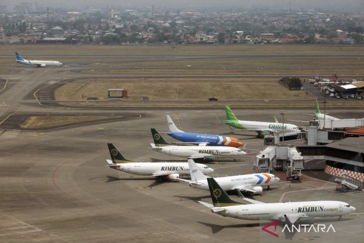
The eruption of Mount Anak Krakatau in early September 2026 has sent towering plumes of volcanic ash high into the atmosphere, critically disrupting air travel across major regions of Indonesia including Java and Sumatra, and forcing the temporary closure of multiple international and domestic airports. While passengers frequently assume that flight cancellations during volcanic activity are solely a precaution for reduced visibility, aviation authorities and geological experts emphasize that the danger runs far deeper. Volcanic ash is not ordinary dust; it is a complex, highly abrasive mixture of sharp rock fragments, minerals, and glass shards that poses a catastrophic threat to aircraft structural integrity and jet engine functionality.
As the crisis unfolds, over 1,500 flights have been canceled or severely delayed, stranding approximately 170,000 passengers nationwide. The aviation sector’s stringent response highlights the unforgiving physics of jet engines encountering microscopic silicate particles. With ash plumes reportedly reaching staggering altitudes of up to 50,000 feet on the Sumatra side, commercial airlines, air traffic controllers, and disaster mitigation agencies remain locked in high-stakes coordination to prevent potential airborne disasters.
Chronology and Escalation of the 2026 Eruption
The volcanic unrest at Anak Krakatau—situated in the Sunda Strait between Java and Sumatra—intensified late in August 2026, culminating in a major explosive event during the first week of September. The initial eruption propelled thick columns of ash into the stratosphere, where prevailing wind patterns rapidly transported the particulate matter across heavily populated and economically vital regions, blanketing parts of West Java, Lampung, and even metropolitan Jakarta.
By September 6, 2026, satellite tracking and pilot reports confirmed that the volcanic cloud had ascended to an altitude of roughly 50,000 feet. This elevation placed the hazardous material directly inside the cruising altitudes utilized by commercial wide-body and narrow-body aircraft. In response to the encroaching plumes, the Ministry of Transportation, in collaboration with AirNav Indonesia, ordered the immediate suspension of operations at eight major airports across the affected zones. Major transportation hubs, including Juanda International Airport in East Java, reported dozens of immediate flight cancellations, triggering widespread logistical bottlenecks and compelling citizens in urban centers to hunt for protective face masks against respiratory hazards.
The Deadly Mechanics of Volcanic Ash Inside Jet Engines
To understand why a seemingly distant volcanic cloud can ground an entire fleet of modern aircraft, one must examine the physical and chemical properties of volcanic ash. Unlike common meteorological clouds composed of water droplets or ice crystals, volcanic ash consists of pulverized rock and hard, abrasive mineral crystals.
When a commercial airliner flies through an ash cloud, these microscopic particles are ingested in massive quantities by the high-bypass turbofan engines. Inside a jet engine, operating temperatures routinely exceed 1,400 degrees Celsius (2,550 degrees Fahrenheit)—far above the melting point of volcanic glass, which typically ranges between 800 and 1,200 degrees Celsius.
Upon entering the combustion chamber and turbine sections, the solid ash particles melt into a liquid state. As this molten material is pushed further back into the engine, it encounters the cooler turbine stator vanes and rotor blades. Here, the liquid glass solidifies rapidly, forming a hard, rock-like glaze. This buildup chokes the internal cooling passages, disrupts smooth airflow, and causes rapid compressor stalls. Furthermore, the relentless abrasive action of un-melted ash particles rapidly erodes turbine blades, compressor casings, and fuel nozzles, drastically reducing engine thrust and, in worst-case scenarios, inducing a complete engine flameout.
Historical Precedents and Aviation Safety Statistics
The aviation industry’s cautious protocol regarding volcanic ash is forged through past disasters. According to historical data compiled by the United States Geological Survey (USGS) and international aviation safety bodies, encounters between aircraft and volcanic ash clouds have frequently escalated into life-threatening emergencies.
A watershed moment in aviation history occurred in 1982, when a British Airways Boeing 747 flying from London to Auckland inadvertently entered a dense, unmapped ash cloud generated by the eruption of Mount Galunggung in West Java, Indonesia. The microscopic abrasive particles stripped the aircraft’s cockpit windshields of their transparency and sandblasted the landing lights. Crucially, all four jet engines ingested massive quantities of ash, resulting in simultaneous flameouts. The aircraft plunged approximately 25,000 feet in a desperate glide before the flight crew successfully restarted three of the engines, eventually executing a miraculous emergency landing at Jakarta’s Halim Perdanakusuma Airport with zero fatalities.
Broader USGS data tracking international incidents up to 2009 documents 129 direct encounters between commercial aircraft and volcanic ash clouds. Of those documented events, 79 resulted in varying degrees of severe mechanical damage, while nine incidents involved total engine failure while airborne. These historical scars explain why modern aviation regulators maintain a zero-tolerance policy toward flying anywhere near active volcanic plumes.
Beyond the Engines: Cockpit Visibility and Structural Wear
While catastrophic engine failure represents the most dramatic hazard, volcanic ash threatens multiple secondary systems on an aircraft. The sharp, angular nature of the silicate particles acts like industrial sandpaper when hurled against an aircraft moving at hundreds of miles per hour.
Cockpit windshields exposed to even brief encounters with volcanic ash are instantly pitted and etched, reducing forward visibility to zero—a perilous condition compounded by the frequent failure of onboard electrical sensors. Pitot tubes, which measure airspeed, can become clogged with ash, providing erroneous data to flight instruments and confusing automated flight-control computers.
Moreover, prolonged exposure to lower concentrations of volcanic aerosols accelerates the mechanical wear and tear on fuselage skin, control surface hinges, and air-conditioning intake filters. Airlines forced to fly near peripheral ash zones face exorbitant maintenance bills, requiring meticulous engine borescope inspections and complete replacements of compromised components before an aircraft is cleared to return to service.
The Illusion of Altitude and the Challenge of Detection
A common question raised by frustrated travelers is why aircraft cannot simply fly higher or lower to bypass the ash cloud. The dynamics of volcanic eruptions render this workaround ineffective in many scenarios.
Unlike localized storm clouds that occupy predictable atmospheric tiers, volcanic ash can be thrust deep into the stratosphere, stretching across multiple vertical layers. In the case of the Anak Krakatau eruption, ash plumes reaching 50,000 feet surpassed the maximum service ceiling of standard commercial airliners, which typically cruise between 31,000 and 43,000 feet. Additionally, upper-level wind shear can distort and spread ash over thousands of square kilometers in unpredictable directions, making vertical evasion a high-risk gamble.
Compounding the navigation challenge is the fact that volcanic ash clouds are notoriously difficult to detect. Unlike traditional rain clouds or dense fog, dry ash clouds often blend seamlessly with ordinary meteorological clouds or appear transparent on standard weather radar systems, particularly at night or under low-light conditions. Pilots cannot always rely on visual cues until they are already inside the danger zone. Consequently, authorities rely heavily on a sophisticated network of ground-based vulcanologists, meteorological satellites, Volcanic Ash Advisory Centers (VAAC), and real-time pilot reports to map shifting hazard zones.
Socioeconomic Implications and Official Responses
The immediate closure of eight airports across Java and Sumatra, alongside the cancellation of over 1,500 flights, demonstrates the far-reaching economic toll of natural disasters on national infrastructure. Airlines face severe revenue losses from grounded fleets and passenger compensation claims, while tourism operators in key Indonesian destinations report immediate cancellations.
Government ministries, including the Ministry of Transportation and the National Board for Disaster Management (BNPB), have defended the sweeping closures as an unavoidable sacrifice for public safety. Aviation authorities stress that while logistical delays and stranded passengers cause immense short-term frustration, preventative groundings successfully eliminate the existential risk of mid-air catastrophes.
As Mount Anak Krakatau continues its intermittent eruptive cycle, disaster management teams remain on high alert, continuously updating airspace restrictions in real time. For the traveling public, the ongoing disruption serves as a stark reminder of the immense raw power of geological forces and the uncompromising safety margins required to navigate the skies safely.